South Coast Series


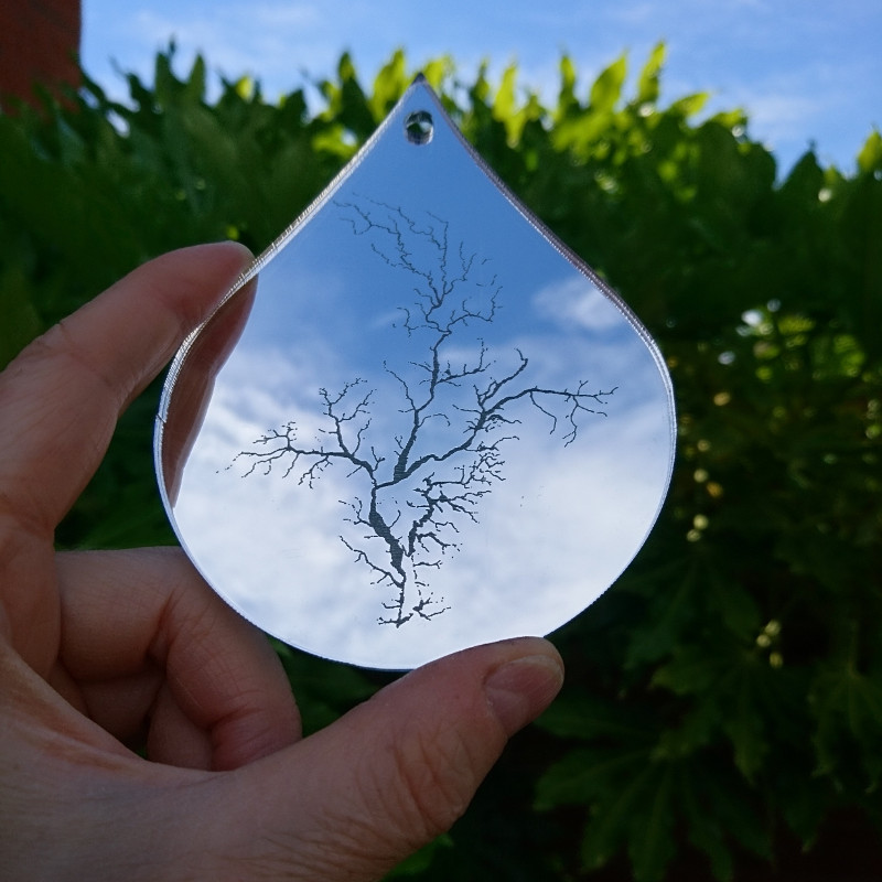
Series of 21 digital images, realised as
(a) giclee prints on archival quality paper, each 16″ x 16″ unframed
(b) dye sub prints on chiffon fabric with steel hanging, approx 20″ x 20″ unframed
(c) “Drop Slow Tears”, a mobile of laser engravings on clear acrylic droplets
About the Work
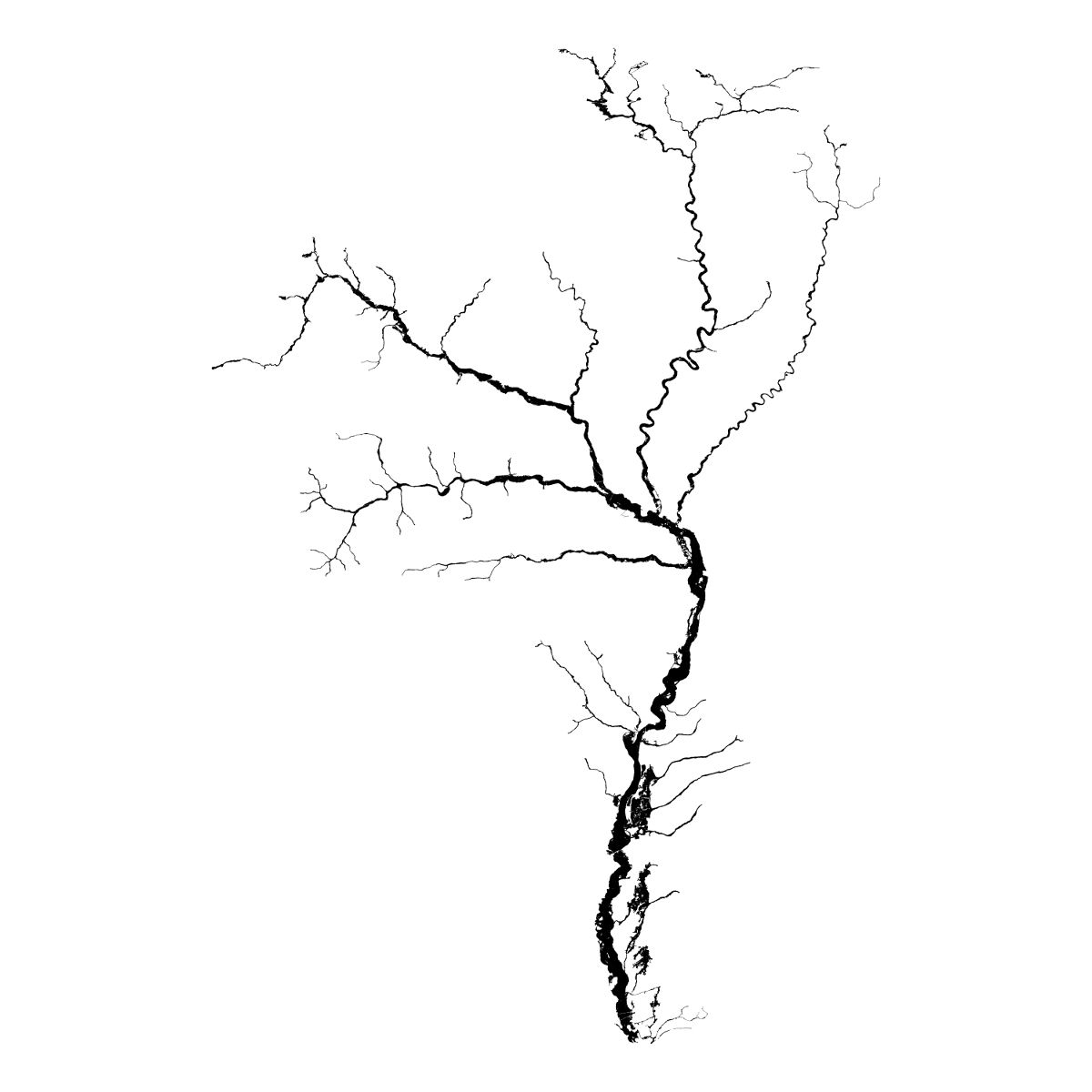
“Green|Blue” visualises the Environment Agency dataset on Risk of Flooding from Rivers and Sea (see below), orienting each catchment to appear as a ‘tree’.
The view from above has become normalised. Google Maps and OS Maps, city centre plans and ‘you are here’ stickers on the boards at local nature reserves, give the impression of omniscience and omnipotence. The very notion of ‘flood risk’ calls both our knowledge and power into question in the face of uncertainty and the force of nature.
What seems to be the most solid and robust is in reality the most fragile and vulnerable. Changing the perspective, looking slant, confers a new understanding and humility.
Available to buy
Please get in touch if you are interesting in purchasing unframed archival quality prints, greetings cards, steel-framed chiffon prints and “Drop Slow Tears”:
Sussex Ouse; Adur; Arun; Test & Itchen; Hampshire Avon; Dorset Stour; Frome & Piddle; Devon Axe; Otter; Exe; Teign; Dart; Tamar, Tavy & Plym; Fowey; Fal; Camel; Torridge; Taw; Parrett; Somerset Axe & Brue; Bristol Avon
Exhibitions/Installations
- Roll up! Roll up to the Art Vending Machine!
- “Green|Blue” at Greenbelt
- “Green|Blue: Future Shock” video at Fringe Arts Bath
- “Green|Blue: Exe” in “The Observatory” exhibition
- Selected work at “Makers of the Multiverse”
- “Green|Blue” in Exeter Cathedral
- “Green|Blue: Exe” at the AWEsome Art Fair
- Clare’s Open Studio
- “Green|Blue” in the Dartington Garden Room Gallery
Talks/Workshops
- “The Art of Following Your Nose” at PechaKucha Dartmoor
- Talk on “Green|Blue” at Pint of Science
- Kaleider Lunchtime Talk on “Green|Blue”
- PechaKucha on “Green|Blue” at Greenbelt
Academia
Articles
Reflections on the Blog
News
- Art Work
- Update on the Art Vending Machine
- Review of “Green|Blue” on Phonic FM “Culture & Review” show
- “Green|Blue” featured in the Church Times round-up of Greenbelt
- “Patterns” at St Sidwells
- “Green|Blue” to show at Greenbelt
- Hanging “Green|Blue” in the Chapter House
- Private Viewing at Exeter Cathedral
- Coming soon… Art Week Exeter… eek!
- “Green|Blue” selected to show at Exeter University
Data Sources
Contains public sector information licensed under the Open Government Licence v3.0.
Risk of Flooding from Rivers and Sea
Environment Agency
Get latest ESRI Shapefile
Publication date: Mar 2015
Previously known as NaFRA Spatial Flood Likelihood Category Grid. This national assessment of flood risk for England shows the chance of flooding from rivers and/or the sea, based on cells of 50m. Each cell is allocated one of four flood risk categories, taking into account flood defences and their condition.
Catchment Abstraction Management Strategy (Reference) Boundaries
Environment Agency
[Shapefile no longer updated]
Publication date: Nov 2012
The CAMS Abstraction Management Strategy (Reference) Boundaries are an external reference dataset giving an indication of where technical assessments have been undertaken.
Acknowledgements
Green|Blue was supported by Kaleider